Brazil (hgeoHNOR2020)
|
Authors: R.T. Luz, et al.
|
Created: 2020
|
Resp: M.K. Lima
|
Description:
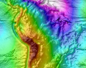
The hgeoHNOR2020 hybrid quasi-geoid model for Brazil was developed by the Geodesy Coordination of the Instituto Brasileiro de Geografia e
Estatística (IBGE) to convert GNSS-derived ellipsoidal heights in the SIRGAS2000 reference frame (that is based on ITRF2000, epoch 2000.4)
into normal heights in the REALT-2018 system, accounting for the two Brazilian vertical datums, Imbituba and Santana. The model was developed by
fitting the residuals between the MAPGEO2015 gravimetric model and a set of 1,297 selected GNSS/levelling stations through Least-Squares Collocation
(LSC), using the GEOGRID program of the GRAVSOFT package. The resulting correction grids were added to MAPGEO2015 to obtain 5' x 5' grids of height
conversion values and associated uncertainties, computed separately for the Imbituba and Santana vertical datums. The comparison between the hgeoHNOR2020
model and the selected GNSS/levelling stations shows a root mean square error (RMSE) of approximately 6.5 cm. The model is less reliable in regions with
sparse GNSS/levelling coverage, particularly in western Brazil, where the original MAPGEO2015 values were retained. The IBGE web portal offers an online
computation service based on a bicubic spline interpolator.
References:
IBGE (2023). Modelo hgeoHNOR2020 para conversão de altitudes geométricas em
altitudes normais, 2nd edition.
Série Relatórios Metodológicos, Vol. 47, Instituto Brasileiro de Geografia e Estatística (IBGE), Rio de Janeiro. ISBN: 978-85-240-4589-9 (in Portuguese).
R.T. Luz, E.M.L. Xavier, N.V. Lengruber, M.A.A. Lima, S. Soares, M.K. Lima, J.C.S. Siqueira, E.G. Santos (2021). The new
hgeoHNOR2020 altitude conversion model and the compatibility between altitudes and depths in the coastal zone (ALT-BAT). Proceedings of the 17th International Congress of the Brazilian Geophysical Society,
Rio de Janeiro, Brazil, 8-11 November 2021.
|

|